

Aircraft Icing and How It Affects Your Flight
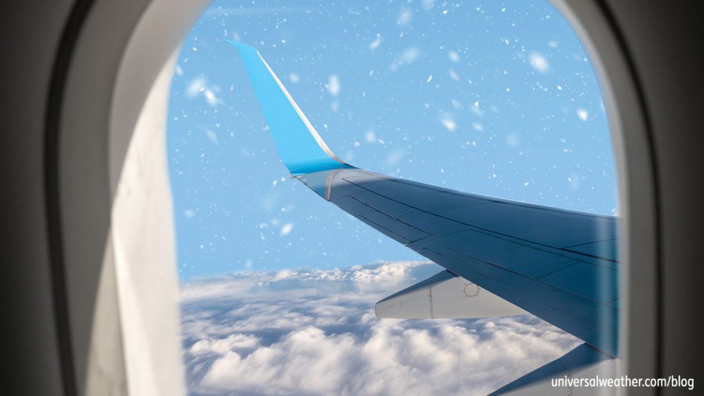
It’s extremely important that pilots understand the dangers of aircraft icing. Even if an airplane is equipped and certified to operate in known icing conditions, there are limitations. Flying into known or potential icing situations without thorough knowledge of icing and its effects should be avoided. Pilots need to know the adverse effects of icing on aircraft systems and control, as well as procedures to be adopted during icing encounters.
Here’s an overview of what you should know about aircraft icing:
1. What’s the definition of aircraft icing?
The severity of aircraft icing depends on the rate of accumulation, effectiveness of available de-icing equipment and actions a pilot must take to avoid or combat accumulation of ice. The pilot determines severity through an assessment of how well the aircraft can handle the accreted ice. Moderate or severe icing reported by a small aircraft carries a different meaning than the same severity reported by a large aircraft. Due to inexperience in ice identification (and because the differences among icing types are often small), ice type is often inaccurately reported.
2. What are the different categories of aircraft icing?
“Trace icing” refers to a rate of ice accumulation just slightly greater than the rate of ice loss due to sublimation. This category of icing is not hazardous, and no action is normally necessary when this category is encountered for one hour or more. “Light icing” indicates that the rate of ice accumulation may create a problem if the aircraft remains in this environment for one hour or more. The occasional use of de-icing or anti-icing equipment may be necessary to remove or prevent accumulation. “Moderate icing” indicates a rate of accumulation so great that even a short encounter can become hazardous. The use of de-icing or anti-icing equipment – along with a heading or altitude change – is usually necessary. In the case of “severe icing,” the rate of accumulation is such that de-icing or anti-icing equipment cannot adequately control or reduce the hazard. An immediate heading and/or altitude change is typically necessary.
3. How do we differentiate among different ice types?
There are three types of icing: Rime, Clear and Mixed. “Rime ice” grows when droplets rapidly freeze upon striking an aircraft. This is the most common form of aircraft icing, but the least serious, as it typically forms on the leading edges, where de-ice devices are installed. Rime ice can, however, pose a hazard for aircraft without de-icing or anti-icing equipment or with non-activated de-icing equipment.
“Clear ice,” on the other hand, is a more hazardous ice type, as it is denser than rime ice and can spread over a part of the airframe’s surface that is not protected by de-icing or anti-icing equipment. It tends to disrupt airflow more than rime ice. Still, in most cases, clear ice can be removed nearly completely by de-icing devices.
“Mixed ice” is a combination of rime and clear ice that can appear as layers of relatively clear and opaque ice when examined from the side. Mixed ice can also spread over a portion of the airfoil not protected by de-icing or anti-icing equipment.
4. What conditions need to be met for ice to form on an aircraft?
Rime ice favors colder temperatures, lower liquid water content and small droplets. Clear ice forms when only a small portion of the drop freezes immediately, while the remaining water smears over the aircraft surface and gradually freezes.
5. How can ice affect the flight of an aircraft?
One early symptom of airframe icing is decreased air speed. Clear icing can be especially hazardous because it tends to form “horns” near the top and bottom of the leading edge, greatly affecting airflow. Wind tunnel and flight tests have shown that frost, snow and ice accumulations on leading edge or upper surface of the wing no thicker than a piece of course sandpaper can reduce lift by 30% and increase drag up to 40%.
6. How do icing risks differ from different types of clouds?
Clouds form as the atmosphere becomes saturated with respect to liquid or ice. Since clouds or precipitation must be present for icing to occur, all cloud formations have the potential to increase the icing threat. The amount of liquid water droplets at temperatures below freezing in any given cloud is a key factor in determining icing potential. The most severe risk of icing is caused by super cooled large droplets (SLD), normally encountered along warm fronts and stratiform clouds. These large droplets tend to form a very lumpy-textured ice that can significantly disrupt the airflow and aerodynamics of the aircraft. Cumulus clouds have greater vertical extent, but far less horizontal extent, and are generally – with the exception of CB-type clouds – less hazardous.
7. What are the temperatures associated with icing risks?
In some cases, temperature can be a good indicator for diagnosing the type of icing expected. There are often instances, however, where the temperature-icing relationship is not well defined. Rime icing is the most frequently-reported icing and usually occurs between -15 and -40 degreesoC. Mixed icing is often reported between -10 and -15 degrees°C, while clear icing is generally reported between 0 and -10 degrees°C.
8. When icing is predicted, what are the recommendations with regard to the route?
As most business aircraft fly at altitudes above where most icing conditions occur, the #1 recommendation is to fly above the icing threat. The #2 recommendation is to flight-plan a route away from deep lows or significant frontal activity. The main threat for icing conditions occurs during takeoff and landing, as the pilot may need to fly through icing conditions. Use extreme caution when flying through a front that may contain freezing rain, freezing drizzle or other hazardous weather conditions.
Conclusion
It’s important to plan ahead and check the weather the night before your flight to determine if snow, freezing rain or frost is in the forecast. When it comes to avoiding ice, pilot reports (PIREPS) as well as SIGMETS and AIRMETS, are among the best tools at your disposal. Always ask your 3rd-party provider for those during a preflight briefing and keep the “big picture” in mind when operating around potential icing conditions.
Questions?
If you have any questions about this article, contact me at stevearbogast@univ-wea.com.