

Risks Volcanic Activity and Ash Clouds Have on Business Aviation – Part 2: Avoiding Potential Risks
This business aviation blog post is the second part in a series covering the risks volcanic ash has on aviation and continues from our previous post.
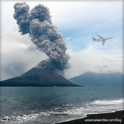
Whenever operating a business aircraft to areas prone to volcanic activity, being aware of the risks and how to deal with active volcanic events should be a pre-trip consideration. The good news is that volcanic activity prediction, and ash cloud tracking are much better than they were even a few years ago. Here are some tips for avoiding the potential risks associated with volcanic activity:
1. What can operators do to avoid or circumvent such events?
Be vigilant when traversing known volcanic regions. Obtain information on active volcanoes prior to departure and as needed while en route. In the planning process, have your 3rd-party provider supply timely updates of any volcanic activity. Various websites providing information on monitored volcanic activity are provided in Section 5 of this article. If dealing with a volcanic ash cloud en route, maintain constant contact with Air Traffic Control (ATC) and request updates from your 3rd-party provider, while monitoring both Pilot Reports (PIREPS) and significant meteorological information (SIGHMETS).
2. How is volcanic activity tracked?
The International Civil Aviation Organization (ICAO) has created nine Volcanic Ash Advisory Centers tasked with monitoring volcanic ash plumes and clouds within their assigned airspace. Advisories are posted on relevant websites and forwarded to various ATCs. Observation and satellite imagery is posted at the time an eruption is detected and updated every six hours, unless there’s a significant change in the eruption or ash cloud. Ash fall affecting a particular airport will be indicated via notice to airmen (NOTAM), surface observation and terminal aerodrome forecasts (TAFs).
3. What sort of ash cloud tracking is possible?
Volcanic advisories contain the elevation, name and location of the volcano. They take advantage of various data sources – satellite imagery, PIREPS, surface observations and webcams – to detect and forecast movement of ash clouds. This typically includes an 18-hour forecast of ash cloud concentration and movement with the base and top of the ash cloud, as well as the geographical extent of the ash cloud in lat/long and associated graphics.
4. What are the difficulties in forecasting and tracking ash clouds?
It’s always a challenge forecasting a volcanic eruption with initial ash cloud dispersion. Some volcanoes are constantly monitored, and the information reported is very dependable. However, many volcanoes are not monitored, and initial eruption data may be suspect. Prediction modeling is usually accurate in dealing with direction and elevation of ash clouds, especially at higher altitudes; however, it’s difficult to predict accurately the movement and concentration of ash clouds that have moved far away from the source. There are various models used for volcanic ash forecasting, and they may all have different outcomes. You may find, for example, that European ATC may favor a European forecast model, while the Federal Aviation Administration (FAA) may favor a U.S. forecast model.
5. Are there websites operators can use to gain more insight on volcanic ash or volcanic activity updates?
- http://www.ssd.noaa.gov/VAAC/vaac.html provides links to the nine Volcanic Ash Advisory Centers.
- http://volcanoes.usgs.gov/ provides updated status on Volcanic Activity affecting U.S. interests.
- http://www.avo.alaska.edu/ is a good website for volcanic activity across Alaska and eastern Russia.
- http://www.volcano.si.edu/index.cfm is the Smithsonian Institution’s website with a great deal of current and historical information on volcanic activity.
Conclusion
During the trip planning phase, contact your 3rd-party provider to consider the potential volcanic activity impact along your route of flight and at landing destinations. If there’s any volcanic activity, be vigilant and ensure that updates are sent to you before and during operation.
Questions?
If you have any questions about this article, contact me at stevearbogast@univ-wea.com.